Areas of Application:
- Visually impaired
- Blindness
Description:
The BIT centre of the Bavarian Association for the Blind and Visually Impaired offers maps for any address in 3D design.
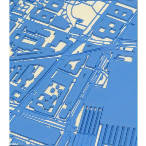
The tactile maps are made of sturdy, slightly flexible plastic and are produced using a 3D printer. The size is 17x17 cm with a standard scale of 1:2000. The map allows good recognition of even dense inner-city areas. Building footprints, streets, footpaths, pavements and railroad lines can be easily differentiated. Rivers and lakes can also be recognized on the basis of the surface structure. The desired address is indicated by a small tip. The map measures 340 by 340 meters.
The latest map material from OpenStreetMap is used for the models. An application converts the essential elements into a three-dimensional representation.
Using 3D maps requires some practice. Explanations in exchange with a sighted person, via technical assistive products (e.g. map services with voice-over) or the additionally orderable, individual description by the BIT center are recommended.
An individual description of the map is also possible. It contains the depicted streets, essential buildings and elements of the map and can be ordered additionally for EUR 15.00 as a DAISY CD or MP3 file by e-mail. Other scales and map sizes are possible by individual agreement.
The maps are produced individually. Exchanges or returns are therefore not possible.
This offer is a pilot project of the provider.
Price (without guarantee):
The price is available on request from the manufacturer / distributor.
REHADAT does not sell any products
Please contact the manufacturer or distributor.
Manufacturer:
no data available
Distributor:
Bayerischer Blinden- und Sehbehindertenbund e.V.
Landesgeschäftsstelle
Arnulfstr. 22
80335 München
Telephone:
089 55988-0
Email:
info@bbsb.org
Homepage:
https://bbsb.org
No data available
Keywords
- blindness |
- educational material |
- geography |
- ISO 22 15 |
- ISO 22 15 21 |
- map |
- natural science |
- tactile |
- visual impairment
ISO
Reference Number:
M/266017
Last Update: 26 Mar 2024